CYPRUS UNIVERSITY OF TECHNOLOGY

CUT was established by law in 2004, and enrolled its first students in 2007. With its orientation towards applied research, the University aspires to establish for itself a role in support of the state and society in their efforts to confront problems, which cover all areas of science and technology. CUT involvement in research has been recognized from the fact that within the last four years, projects with more than 20M Euros have been funded. CUT is an advanced University equipped with the most modern infrastructures and technological equipment which make it possible to be the strongest, on the island, in research with specialised units directed by distinguished professionals. In this project CUT is involved with two Laboratories. The first, the Digital Heritage Lab, is directed by Prof. Marinos Ioannides and it is responsible for semantics and symbolic representation. The Laboratory of Digital Cultural Heritage is a prototype of cooperation and has rapidly achieved world-spectrum collaboration research programs. The lab has created a unique and wide research network with great potentials for future activities. The input of the lab is significant, since it promotes and supports an advanced scientific basis. In the meantime the DHL has a budget of 1.2 MEuro exclusively for research and development in the area of digital Cultural Heritage documentation and protection. The laboratory is a partner of the newly established VR (Virtual Reality) CAVE (Computer Automated Virtual Environment) for facilitating the advancement of multi-disciplinary research and development in Cyprus (http://vrcave.com.cy/research/) and has 3D scanners, programmable 3D cameras, eyetrackers. The Remote Sensing & Geo-informatics Laboratory of the Department of Civil Engineering and Geomatics of the Cyprus University of Technology is fully equipped with the following resources: 8 GPS units with a reference station, 11 optical Leica Levels, 11 digital Leica levels, 6 Leica Rugby laser levels, distometers, laser scanner, PDA, 3 field spectro-radiometers (GER1500 & SVC 1024), 2 sun-photometers Microtops II, 1 CIEMEL sun-photometer, photogrammetric stations, UAVS (copters, airborne systems etc) etc. A modern computer lab of 25 seats has been already established. A field spectroscopy lab has been already established consisting of 3 field spectro-radiometers, calibration lab (calibration sphere etc). The Lab has the APOLLO LEICA software that enables efficient management of large amount of geographical data. The following softwares have been already acquired for the lab needs: ARCVIEW, MAPINFO, ER MAPPER, ERDAS IMAGINE, AUTOCAD, MAPCIVIL, REVIT etc. The Laboratory has been involved in more than 40 funded research projects with funding sources from FP-6, FP-7, MED, LIFE+, EC regional and structural funds etc in the areas of: applications of space & remote sensing, field spectroscopy, photogrammetry, laser scanning, GPS, documentation, and GIS oriented for CH and Archaeology. The lab coordinates more than 15 projects.
Main roles in INCEPTION
- T 1.1, T 1.2, T 1.3: Being responsible as a leader of T 1.3 for the cross-disciplinary approach to knowledge consolidation, by the collection analysis and sharing of knowledge from various sources. Active role in value – added assessment of cultural heritage, main needs to for data precision and 3D accuracy, visualization production systems, relation with historic documents.
- T 2.1: Support procedure of 3D data acquisition, active role in the definition of a common procedure for historical data retrieval; cataloguing and digitization; knowledge of geometric, surface and structural features.
- T 5.1, T 5.6: Being responsible as a leader for T 5.6 of the demonstration case in Cyprus by coordinating the surveying project (full geometric documentation of the monument, using a combination of digital techniques for data acquisition and methodologies for data processing).
- T 6.1, T 6.2, T 6.3: Being responsible as a leader of T 6.2 for the deployment of 3D VR/AR models with integral narratives (as digital surrogates with digital artifactual values) on the heritage sites
- T 7.1, T 7.2, T 7.3: Active participation in dissemination plan, publications in professional journals, workshops and presentation to professional associations; development of exploitation strategy and plan.
- T 8.1, T 8.3: Active participation in management meetings (general assembly), fulfilment of all obligations for reporting.
Key persons involved
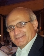
MARINOS IOANNIDES - PhD, ProfessorDr. Marinos Ioannides is currently the chair of the newly established and unique Digital Heritage lab of the Cyprus University of Technology in Limassol. The lab is the fastest growing research centre on the island and has been awarded a number of EU projects within its one year debut with a total budget of 1.2 MEuro. Ioannides specialized in 3-D Reconstruction from Digitized Data for his PhD. His software 3D-Reconstruction engine was developed in cooperation with IBM Germany and is available and running in more than 32 research centers around the world. He is also a member of the E.U. Digital Library Europeana Network as well as representing Cyprus in the European Commission Group of Experts of the Digitization and Preservation of Cultural Heritage Content. He was the chairman of the joint international conferences VAST2006 (www.cipavast2006.org) and VSMM2008 (www.vsmm2008.org) in Cyprus and the permanent chair of the biannual EuroMed international conference www.euromed2012.eu and www.euromed2014.eu which is dedicated to the area of Digital Heritage. He is the chief Editor of the International Journal of Heritage in the Digital Era (www.multi-science.co.uk/ijhde.htm) and a founding member and national coordinator of the newly established EU Research Infrastructure Consortium DARIAH-ERIC (www.dariah.eu). In 2010 he was awarded from the Spanish and European Association of Virtual Archaeology the Tartessos prize for his achievements in the area of 3D-documentation in Cultural Heritage. Ioannides is also the Chief Editor of the International Journal of Heritage in the Digital Era, published by MultiScience in the UK: www.multi-science.co.uk/ijhde.htm |  |
ATHOS AGAPIOU - PhD, Postdoc, EngeneerDr. Athos Agapiou is the Head of the Geomatics unit of the Remote Sensing and Geo-Environment Research Group. Dr. Agapiou holds a PhD in the field of “Remote Sensing” from the Department of Civil and Geomatics Engineering, Cyprus University of Technology. Moreover Dr. Agapiou holds another 3 MSc and MA in the field of Archaeology (Department of History and Archaeology, University of Cyprus), Geoinformatics (School of Rural and Surveying Engineering, National Technological University of Athens) and Surveying Engineer (School of Rural and Surveying Engineering, National Technological University of Athens). His scientific interests range in the fields of Remote Sensing, Ground Spectroscopy, Geographic Information Systems. |  |
KYRIAKOS THEMISTOCLEOUS - PhD, Architect, Senior researcherDr. Kyriacos Themistocleous is the Head of the Remote Sensing and UAV unit of the Remote Sensing and Geo- Environment Research Group. Dr Themistocleous is a senior researcher and special scientist at the Department of Civil Engineering and Geomatic. He holds a Bachelor’s of Architecture from the University of Southwestern Louisiana, USA, a Masters of Architecture in Urban Design from the University of Oklahoma, USA and a PhD from the Cyprus University of Technology (Remote Sensing and GIS). He has over twenty years of experience in architectural design, restoration and repair of cultural heritage buildings, preservation of cultural heritage buildings, survey and documentation of cultural heritage buildings, research in sustainable development and environmental energy efficient buildings. |  |